By AAaron Dorman | PinalCentral
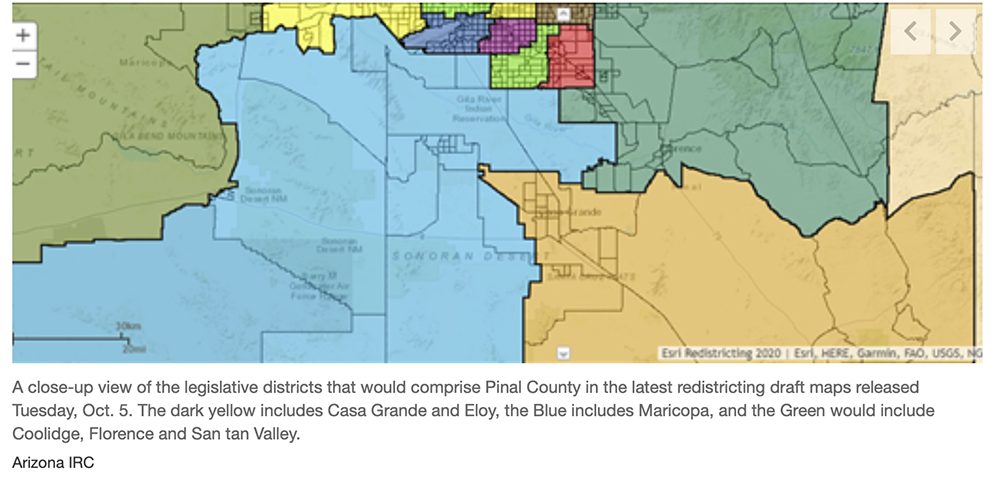
The latest maps drafted by the Arizona Independent Redistricting Commission include major changes for Pinal County and represent a shift from earlier maps to try and avoid splitting up municipalities.
The latest maps, released Tuesday by the IRC, are not final and will be continually adjusted, but they represent the latest templates for the redistricting process.
The congressional district map would have Pinal County mostly contiguous but extending east to New Mexico, combining portions of Graham and Greenlee counties. Earlier drafts showed a district almost entirely comprised of Pinal County by itself.
Related:Redistricting panel’s software frustrates public
The state legislative district draft fixes previous issues with dividing cities like Casa Grande. In the latest draft, Casa Grande and Eloy are now whole and united within a proposed district while Maricopa is in another. Florence and Coolidge are now part of a proposed district with unincorporated San Tan Valley.
Currently, Pinal is part of Congressional District 1, the 11th largest district by size in the country, which extends all the way up to the Four Corners region of the state.
According to Andrea Varela, community outreach coordinator for Rural Arizona Engagement, the commission has not yet sufficiently addressed concerns about representing minority communities.
This is despite recent comments from Chairwoman Erika Neuberg defending the commission’s public hearings process.


