By Jay Taylor | inMaricopa
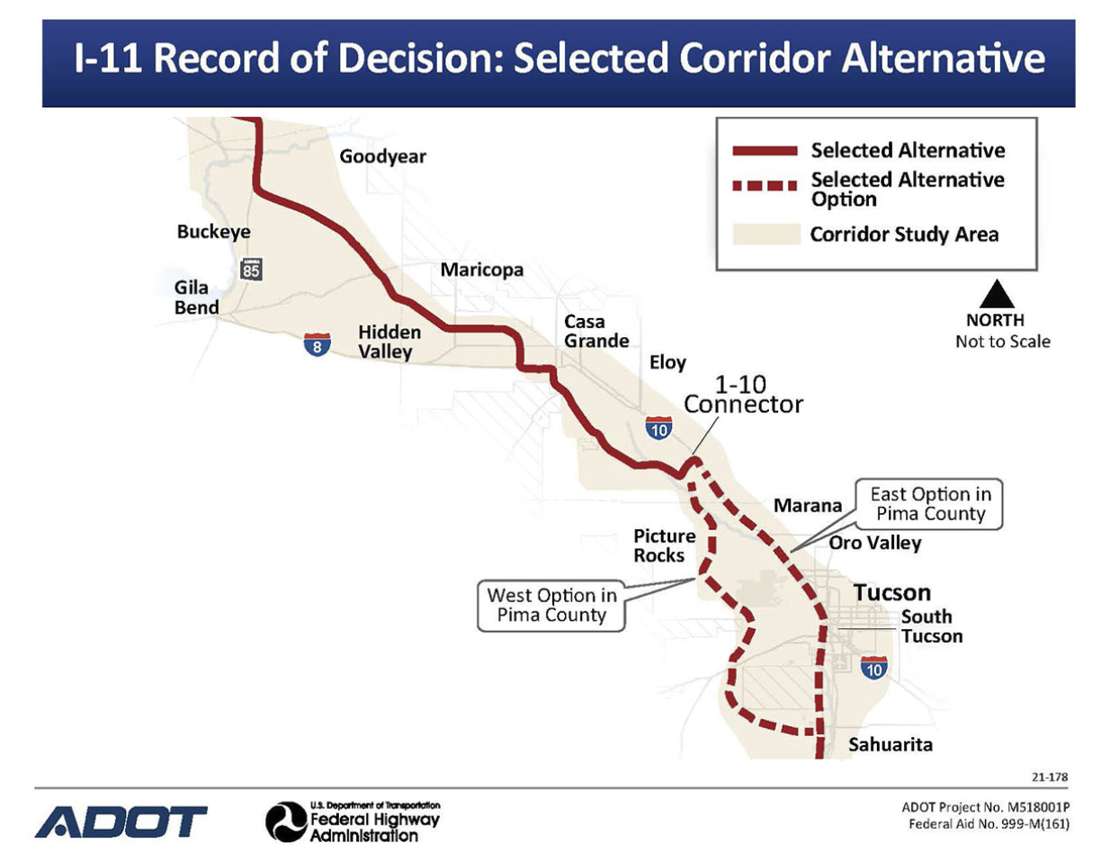
The U.S. Department of Transportation has filed its findings for the Interstate 11 study corridor – a 2,000-foot-wide, 280-mile path stretching from Nogales to Wickenburg – and has recommended a route for the proposed freeway.
After more than five years of study, technical analysis and input from communities and stakeholders, the decision marks a major milestone as the final step in the Tier 1 Environmental Impact Statement process for this proposed highway corridor.
The corridor runs from Wickenburg into the Valley between Goodyear and Buckeye, then moves southeast using a portion of Arizona Highway 85 until it enters Pinal County and runs west of Maricopa and east of Hidden Valley. The route continues south of Maricopa, merging briefly with Interstate 8 before moving south toward Tucson. There are two potential routes through Tucson before the freeway merges with Interstate 19 for the final stretch to Nogales and the Mexican border.
North of Wickenburg, I-11 extends to Las Vegas and then on as yet undetermined route north to Canada.


